
In order to improve the human world around us, surveying is an important aspect. It is the method or science of calculating and evaluating the 3D positions, as well as the angles between them, of various points and distances on the surface. Compass surveying is a must when it comes to calculating angles.
What is Compass Surveying?
Compass surveying is an important survey branch that is generally adopted by angular and linear measurements to determine the location of an object. A compass is used to take angular measurements here and linear measurements are measured using a chain or tape.
Any Compass Survey priorities are as follows:
- If a wide region needs to be surveyed, such as the river’s coastal areas or the course line areas.
- Triangulation becomes difficult if the field is crowded with many specifics and has many barriers to performing chain surveying.
- If the surveyor has a fixed time constraint on a wide and detailed region to perform the survey.
Yet compass surveying still has certain drawbacks. For areas that escape public attention and have the presence of iron ore deposits, magnetic substances such as metal or steel structures, electric cables conveying current, etc., it is not recommended.
Types of Compass
- Magnetic Compass
1. Surveyor’s compass
2. Liquid compass
3. Marine compass or Card compass
4. Prismatic compass or Lensatic compass
5. Thumb compass
6. Solid-state compasses
7. Qibla compass
8. Baseplate compass or Orienteering compass
- GPS compass
- Gyro Compass
- Astro Compass
Following are the compass types used for surveying.
- Prismatic compass
- Surveyor’s compass
- Level compass
A brief description of these types is given below.
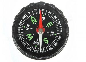
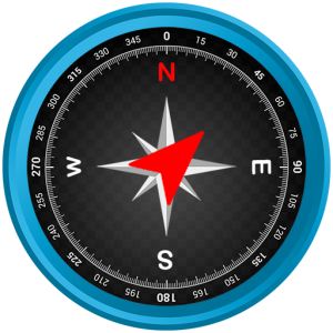
1. Magnetic Compass: In conjunction with the magnetic poles of the earth, the magnetic compass is a compass that has a magnetized needle.
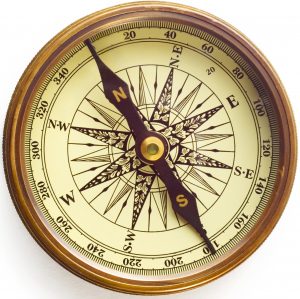
A magnetic compass can decide the magnetic bearings of a line. In either the Whole Bearing System (WBS) or the Quadrantal Bearing System (QBS), the bearings may be determined.
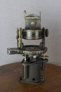
(a) Surveyor Compass: It is an instrument commonly used by surveyors to measure horizontal angles and also to assess a line of sight’s magnetic bearing. A pivoted magnetic needle, a graduated horizontal disc, and a sighting unit constitute the compass. The magnetic needle freely swings over the horizontal disc separated by 360 degrees.
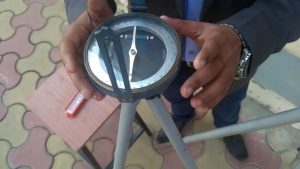
A pair of sights positioned on the north-south axis of the compass is used to determine the horizontal angle. They are normally mounted and leveled using a ball and socket mechanism on a tripod.
(b) Liquid compass:
It is a type of compass in which there is a magnetized needle or dial and the compass card rests on a pivot inside a liquid-filled capsule. The liquid is widely used as mineral oil, lamp oil, ethyl alcohol, white spirits, or distilled kerosene.
(c) Marine compass or Card compass:
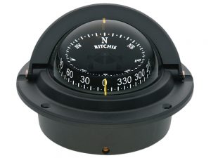
This kind of compass has a fixed needle and a fluid-mounted compass card that rotates according to orientation. It is used on vessels because much of a boat’s motion is taken by the traveling card, which makes it easier to interpret than a needle compass.
(d) Prismatic compass or Lensatic compass: For lining up with an object whose bearing is to be determined, prismatic or lens compasses are used. A prismatic compass has a prism of glass or a mirror and a hairline lid. For map reading, this sort of compass also has a magnifying glass, some kind of light for low light conditions, and a ruler. For military purposes or plotting, it is sometimes used.
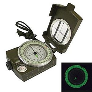
A prismatic compass is the hand compass of a surveyor kept in the hand while using and fitted with peep sights and a triangular glass prism so arranged that a line’s magnetic bearing or azimuth can be read from a circular graduated scale through the prism and at the same time that the line is sighted over.
The name Prismatic compass is given to it because it consists of a prism that is triangular and used more specifically to take measurements. In general, the compass is used to run a transverse line. With respect to the magnetic needle, the compass measures line bearings.
In the case of clockwise and anti-clockwise movement, the angles included can then be conveniently measured using appropriate formulas. Surveyors take two fore-bearing and back-bearing bearings for each survey line in the traverse, which can differ precisely by 180 ° if the local attraction is somehow negligible.
(e) Thumb compass:
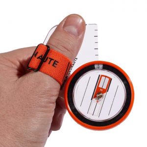
The thumb compass is a smaller type of base plate compass. As the name says, it is set on the thumb and that is what leaves one hand free. In orienteering, a sport in which map reading and terrain connection are paramount, this type of compass is widely used. Fast dampening and high visibility are the key features to aim for in a thumb compass. And on all counts, this thumb compass delivers.
(f) Solid-state compasses:
Solid-state compasses are used mostly in electronic equipment. They also have two or three sensors with magnetic fields from which the microprocessor reads data about the device’s orientation. Usually, they are found in watches, cell phones, and laptops.
(g) Qibla compass:
Muslims use the Qibla compass to describe the road to Mecca so that they know the way to face when praying. The path of prayer in Islam is called qibla, which leads towards the city of Mecca and in particular, the Ka’abah.
(h) Baseplate compass or Orienteering compass:
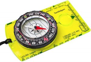
A liquid-filled compass that is mounted on a rectangular base made of clear plastic so that it can be read from a chart is a baseplate compass or orientation compass. It is normally a magnifying lens for map reading, some kind of illumination, and even a ruler for low light conditions.
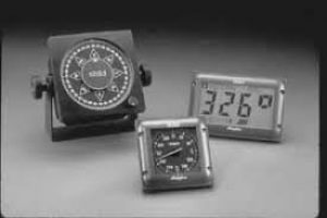
2. GPS compass:
The Global Method of Positioning is the full form of GPS. A GPS compass is considered a compass that uses satellites in a geosynchronous orbit above the Earth to demonstrate the precise position and direction of the bearer’s motion. The GPS compass instruments precisely measure the locations of the antennas on the Earth (latitudes, longitudes, and altitudes) from which the cardinal directions can be measured.
3. Gyro Compass:
A Gyro compass is a type of gyroscope, commonly used on ships using, among other variables, an electrically driven, fast-spinning gyroscope wheel and frictional forces using the simple physical rules, gravity effects, and the rotation of the Earth to locate the true north.
4. Astro Compass:
An astrocompass is a navigational instrument that uses the locations of different celestial bodies to determine the true north direction. It is primarily used in polar areas where there is the unreliability of magnetic compasses and gyrocompasses. In the context of latitude and longitude, it utilizes current time and geographical location. According to these results, any celestial object with a known location is sighted to provide an incredibly precise reading.